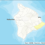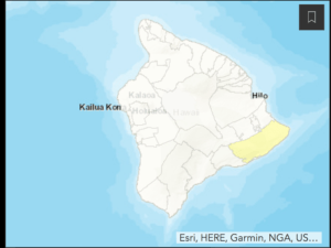
The State Department of Health has posted a map of where the Big Island’s new COVID-19 cases have been in the last 28 days. The legend says there have been 1 to 5 cases confirmed in the highlighted area, the Puna District of the island, in the past 28 days.
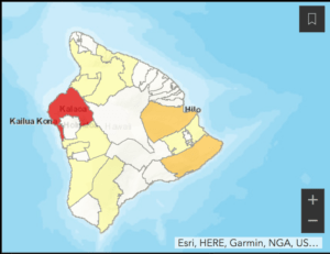
The State Department of Health says both maps below show where those diagnosed with COVID-19 live, as best as DOH could determine, but does not reflect where they may have contracted the virus. DOH reinforces it’s critical to control the spread by wearing a mask, staying at least 6 feet from others in public, and washing hands and surfaces frequently.

The map below shows where all of the island’s cases have been. Right now there is only one active case on the island; this map is cumulative. Any area that is white has zero cases; the light yellow is 1 to 5, the darker yellow is 6 to 10, the orange (there is none) is 11 to 20, and the red is 21 to 50.
