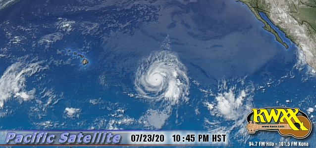
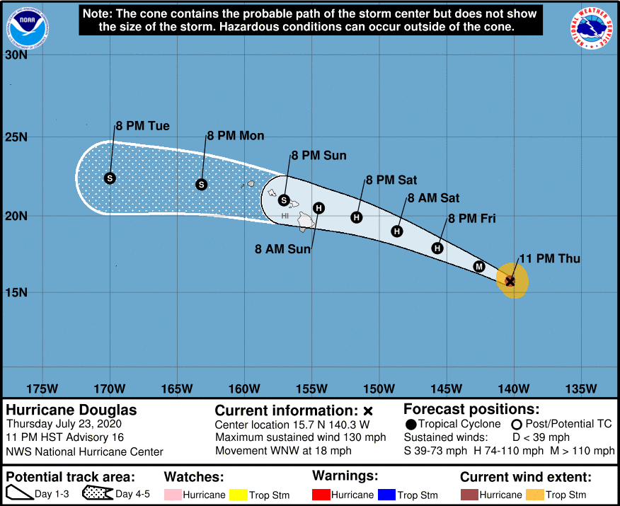
At 1100 PM HST (0900 UTC), the center of Hurricane Douglas was located near latitude 15.7 North, longitude 140.3 West or approximately 1010 miles east-southeast of Hilo. Douglas is moving toward the west-northwest near 18 mph (30 km/h), and this motion is expected to continue for the next few days with a gradual decrease in forward speed and a slight turn toward the west. On the forecast track Douglas will approach the Hawaiian Islands Saturday night, and be near those Islands on Sunday.
Maximum sustained winds are near 130 mph (215 km/h) with higher gusts. Douglas is a category 4 hurricane on the Saffir-Simpson Hurricane Wind Scale. Gradual weakening is expected to begin on Friday and continue through the weekend. Douglas is forecast to be near hurricane strength when it approaches the Hawaiian Islands.
Hurricane-force winds extend outward up to 30 miles (45 km) from the center and tropical-storm-force winds extend outward up to 90 miles (150 km).
HAZARDS
———————-
SURF: Swells generated by Douglas are expected to begin affecting portions of the Hawaiian Islands on Saturday. These swells are likely to cause life-threatening surf and rip current conditions.


