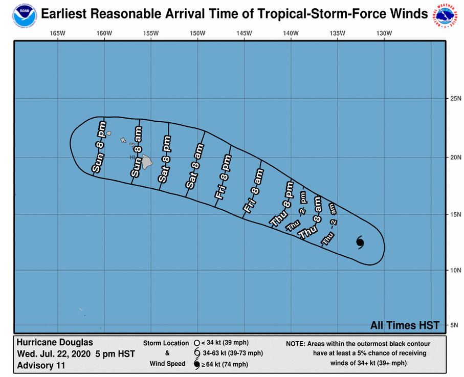
At 500 PM HST (0300 UTC), the eye of Hurricane Douglas was located near latitude 12.5 North, longitude 132.6 West or 1570 miles
east-southeast of Hilo Douglas is moving toward the west-northwest near 17 mph (28 km/h) and this
general motion is expected to continue through Saturday.
Maximum sustained winds have increased to near 100 mph (155 km/h) with higher gusts. Additional strengthening is forecast during the
next 24 hours, and Douglas is forecast to become a major hurricane by Thursday. Gradual weakening is forecast to begin by early Friday.
Hurricane-force winds extend outward up to 15 miles (30 km) from the center and tropical-storm-force winds extend outward up to 105 miles
(165 km). Get the latest satellite and tracking images at www.kwxxweather.com.
