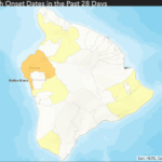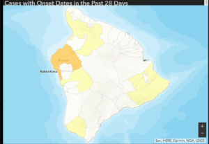
The State Department of Health has updated its online map showing where the onset of new COVID-19 cases are. On the Big Island, there are currently either 8 (State DOH) or 9 (Hawaii County Civil Defense) active cases of COVID-19. Anyplace in yellow on the below map has between 1 and 5 new cases within the last 28 days, and the gold area has 6 to 10 new cases within the last 28 days.
On June 10, 28 days ago, the county’s case count was 81. Today the cumulative count is 96, so the map indicates the location of the most recent 15 cases.
Just within the last day, the gold area–Kailua-Kona up towards and past the Kailua-Kona Airport–moved from yellow to gold, indicating at least some of the very most recent cases are in that area. There are at least two known active cases of COVID-19 which resulted from a COID-19 positive visitor from the mainland staying in the Kona area with her daughter, and giving it to the daughter.
The original State DOH maps and data for the entire state are online at https://health.hawaii.gov/coronavirusdisease2019/what-you-should-know/current-situation-in-hawaii/
