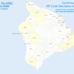
The State Department of Health publishes a map to show where the most recent cases of COVID-19 are on each island. Ryan Ozawa, of the The Hawaii Geographic Information Coordinating Council (HIGICC) was kind enough to attach actual zip codes to the map. The HIGICC is a private non-profit organization consisting of members of Hawai’i’s geospatial community.
This map is as of July 4, with the Big Island having 93 cumulative cases, with 7 active. The map reflects the location of the 12 cases since June 6, 2020, when the island had 81 cases. The light yellow indicates the zip code areas that have had between 1 and 5 cases in the last 28 days.
https://www.facebook.com/photo.php?fbid=10104053211508636&set=pcb.10104053213130386&type=3&theater
To follow Ryan Ozawa, go to Facebook.com and put Ryan Ozawa in the search bar. Maps for the entire state are posted.
New West Broadcasting extends mahalos to Ryan and to the HIGICC.