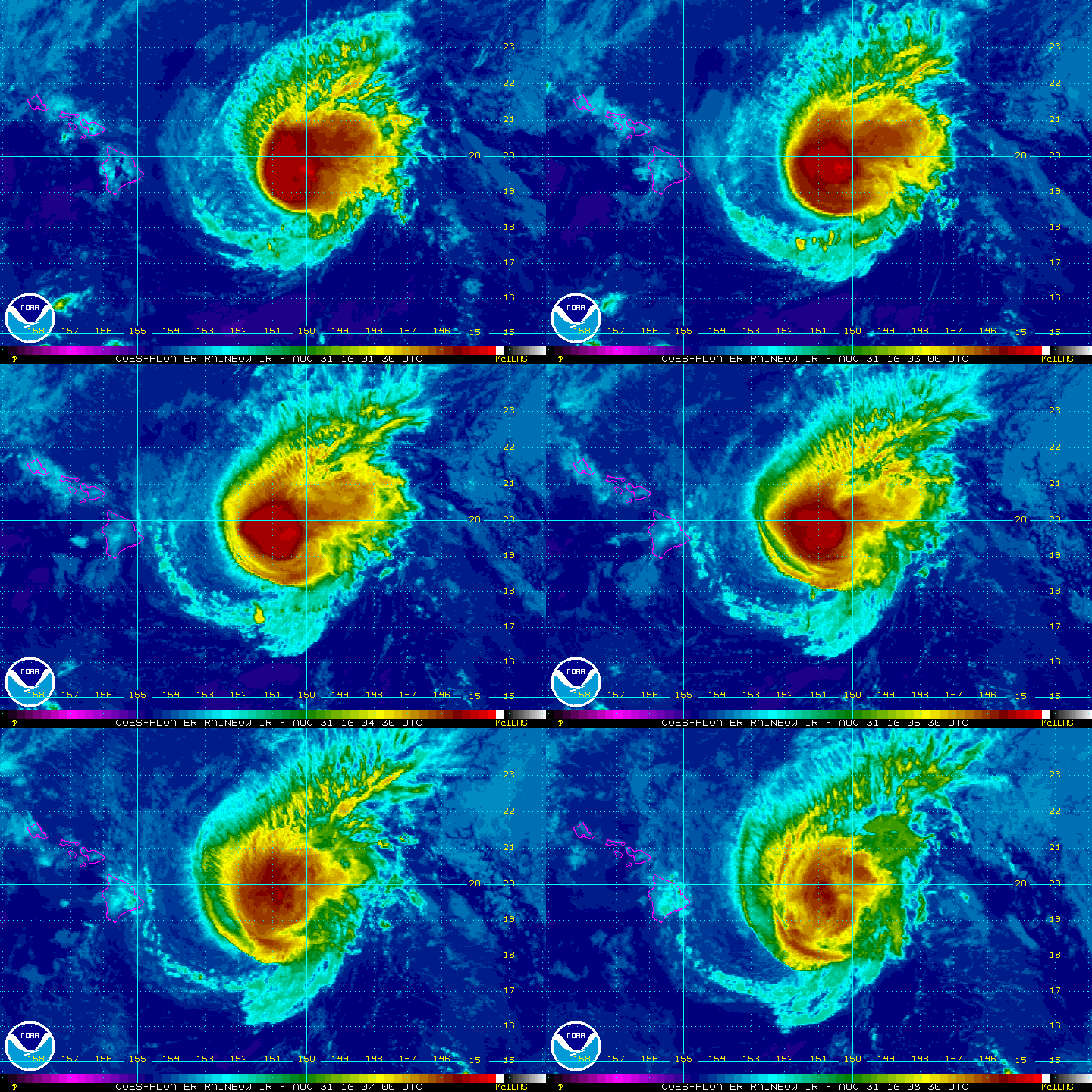
At 1100 PM HST (0900 UTC), the center of Hurricane Madeline was
located near latitude 19.2 North, longitude 151.5 West or 235 miles East of Hilo. Madeline is
moving toward the west near 12 mph (19 km/h) and this motion is
expected to continue for the next couple of days.
Maximum sustained winds are near 90 mph (150 km/h) with higher
gusts. Steady weakening is forecast during the next 48 hours.
Hurricane-force winds extend outward up to 25 miles (35 km) from the center and tropical-storm-force winds extend outward up to 125 miles (205 km).
The estimated minimum central pressure is 980 mb (28.94 inches).
HAZARDS AFFECTING LAND
———————-
WIND: Hurricane conditions are expected to develop over Hawaii
County as early as late Wednesday and continue into early Thursday.
Tropical storm conditions are possible over Maui County, including
the islands of Maui Molokai Lanai and Kahoolawe, late Wednesday into
early Thursday.
SURF: Swells generated by Madeline are expected to build from east
to west across the Hawaiian Islands through tonight, possibly
becoming damaging along east facing shorelines of Hawaii County and
eastern portions of the Island of Maui Wednesday into Thursday.
RAIN: Heavy rains associated with Madeline are expected to reach
Hawaii County on Wednesday, and may impact other Hawaiian Islands later Wednesday through Thursday. Madeline is expected to produce total rain accumulations of 5 to 10 inches across Hawaii County, with isolated maximum amounts near 15 inches, especially over windward portions. Madeline may produce total rainfall of 1 to 3 inches, with isolated maximum amounts up to 4 inches, across Maui County. This rainfall may lead to dangerous flash floods and mudslides.
STORM SURGE: Depending on the track of Madeline, the combination of storm surge and tides could cause normally dry areas near the coast to become flooded. The water could reach 1 to 3 feet above ground if peak surge were to coincide with high tide. The surge would be accompanied by large damaging surf and can vary over short distances.